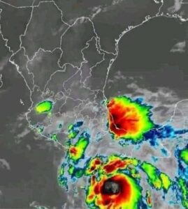
The National Hurricane Center has begun issuing advisories for Potential Tropical Cyclone Nine, which forecasters expect to strengthen into Tropical Storm Helene later today or tonight. The system is currently producing disorganized thunderstorms across the northwestern Caribbean, but experts believe it will soon form a more defined center of circulation.
Once this center develops, the disturbance is expected to intensify. Atmospheric and oceanic conditions appear favorable for rapid strengthening, especially as the system moves into warmer waters. Forecasters are closely monitoring for signs of organization that would mark its transition into a named storm.
Helene is projected to move northward through the Yucatán Channel within the next 24 to 36 hours. From there, it is expected to emerge into the Gulf of Mexico, where further strengthening is likely. The environment in the eastern Gulf may support significant intensification.
Forecast models currently show Helene tracking toward the Florida Panhandle and West Central Florida by Thursday. However, meteorologists caution that even small adjustments to the projected path could shift the areas most at risk. Residents across the region should stay aware of potential changes.
As the storm moves closer to land, Helene could reach hurricane strength. Some projections indicate it may intensify further, potentially approaching Category 2 or Category 3 status before making landfall. Strong winds, heavy rainfall, and dangerous storm surge are all possible.
The potential for inland flash flooding is also a concern. Even communities far from the center of the storm may experience impacts from rainfall bands or localized flooding. Officials emphasize that hazards often extend well beyond the storm’s core.
Residents in Florida, Georgia, and South Carolina are urged to stay updated on forecasts. Conditions can shift quickly, and early awareness is key to preparedness. Emergency officials recommend reviewing hurricane plans ahead of time.
People in the potential impact zone should gather essential supplies, follow local guidance, and remain alert as Helene continues to develop. Staying informed will help ensure safety as the storm approaches.


